When I was heading for the Appalachian Trail, I took two sleeping bags: a winter bag for the cold weather and a summer bag for warm weather. On the Pacific Crest Trail I’m planning to use only one sleeping bag. The higher altitude and generally different conditions will likely require a warm sleeping bag throughout my hike.
On the AT I had synthetic sleeping bags. This was partially because of the cost (down bags are more expensive) and partially because of the weather (Appalachian mountains are rainy and I was concerned for getting my bag wet). Eventually I learned that my tent and dry sacs were dependable enough to not to worry about getting my gear wet. Down dries slowly and is no longer warm when wet.
I negotiated with Finnish outdoor retailer Partioaitta for a sponsorship agreement that allowed me to get the Warmpeace Viking 900 down sleeping bag for the PCT. I chose to collaborate with Partioaitta because they only sell down products with responsible down. Down is an animal product that cannot be collected like wool – without harming the birds. The ethical choice here is to select down that is a byproduct of food industry and not live plucked.
By changing my sleeping bag to down I was able to skim nearly 500 g (roughly 1 lb) from my base weight. And I was able to do this without compromising the warmth. My synthetic bag has a comfort temperature around -10°C (15°F). Warmpeace Viking 900 has comfort temperature of -7°C (19°F) for average female and -14°C (7°F) for average male. In addition to this I’m also taking a silk liner to offer a bit more warmth and easier maintenance of the bag.
Appalachian Trailia lähdin vaeltamaan kahden makuupussin taktiikalla – viileille keleille talvipussi ja lämpimimmille kesäpussi. Pacific Crest Trailille olen varautunut vain yhdellä makuupussilla. Suuremmat korkeudet ja muutenkin erilaiset olosuhteet tulevat todennäköisesti edellyttämään lämmintä makuupussia koko reissun ajaksi.
AT:lla mukanani oli synteettiset makuupussit. Osittain syynä oli kustannus (synteettinen on untuvaa halvempi) ja osittain sää (Appalakeilla sataa paljon ja pelkäsin makuupussin kastuvan). Huomasin kuitenkin telttani ja kuivasäkkieni olevan niin luotettavia, että kastumisesta ei ollut huolta. Untuvahan kuivuu hitaasti eikä märkänä lämmitä.
Neuvottelin Partioaitan kanssa sponsorisopimuksen, jonka myötä sain heiltä Warmpeace Viking 900 -untuvamakuupussin PCT:n vaellusta varten. Valintani kohdistui Partioaittaan, koska heidän myymissä tuotteissa on vain ns. vastuullista untuvaa. Untuva on eläinperäinen materiaali, jota ei voida villan tavoin kerätä eläintä vahingoittamatta. Eettisemmän valinnan voi kuitenkin tehdä tuotteilla, joiden untuva on ruuantutotannon sivuvirtaa sekä ei elävänä nypittyä.
Vaihtamalla untuvapussiin sain vähennettyä reppuni painosta lähes 500 g. Lämmöstä ei tarvinnut silti tinkiä. Aiempi synteettinen talvimakuupussini oli comfort-lämpötilaltaan noin -10°C. Warmpeace Viking 900:n comfort-lämpötilaksi arvioidaan -7°C (keskiverto naiselle) / -14°C (keskiverto miehille). Lisäksi mukaan lähtee silkkinen makuupussin lakana hieman lisälämpöä ja helpompaa puhtaanapitoa tuomaan.
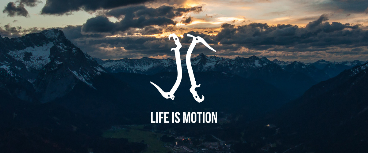
In 2015 I first heard about the Appalachian Trail and in spring 2017 I started to thru-hike that 3500 km (2200 mi) long trail on the east coast of the United States. When I arrived to the Mount Katahdin next fall, I already knew the next destination – the Pacific Crest Trail.
Now five years has passed since my AT thru-hike and it’s time to start the next chapter. In April 2022 I will start thru-hiking the PCT from the US-Mexican border and hopefully by fall I will reach the US-Canadian border. This 4200 km (2600 mi) long trail runs along the west coast of United States, through the states of California, Oregon and Washington.
I will be documenting my hike on several platforms when the cell service allows. Most actively I will be updating this blog, but I will be writing only in Finnish. The posts will be translated to English, but with a delay. In addition I will be blogging for The Trek in English. All platforms that you can use to follow my hike are listed below.
You may support my hike by sharing my content in social media. If you wish to show your support in cash, you may visit my merchandise store (buying my designs or doing your own). If you do any shopping in US Amazon anyway, you can do so by following this link, which allows me to get a small provision (the link won’t work for German, UK, Swedish etc. Amazon). Then I can buy any replacement gear that I might need from Amazon.
Most of all I hope that as many as possible will be thrilled to follow this adventure. Some of my current followers have been inspired to do their own amazing trips and some are following because this kind of adventures are not available for them. I wish that everyone can live and share this trek with me.
Vuonna 2015 kuulin ensimmäisen kerran Appalachian Trailista ja keväällä 2017 lähdin läpivaeltamaan tuota 3500 kilometrin reittiä Yhdysvaltain itärannikolla. Seuraavana syksynä saapuessani Mount Katahdinin laelle oli mielessäni jo seuraava kohde – Pacific Crest Trail.
Nyt viisi vuotta on kulunut AT:n läpivaelluksesta ja aika on kypsä uudelle pitkälle vaellukselle. Huhtikuussa 2022 aloitan PCT:n läpivaelluksen Meksikon rajalta ja toivottavasti syksyyn mennessä saavun Kanadan rajalle. Tämä 4200 km pitkä polku kulkee Yhdysvaltain länsirannikolla Kalifornian, Oregonin ja Washingtonin osavaltioiden läpi.
Dokumentoin matkan etenemistä useisiin kanaviin aina kännykkäverkon salliessa. Aktiivisimmin tulen päivittämään tätä blogia, johon kirjoitan ensisijaisesti suomeksi. Tekstit käännetään englanniksi jonkinlaisella viiveellä. Lisäksi bloggaan The Trekiin englanniksi. Kaikki kanavat, joista vaellusta voi seurata löytyvät alta.
Reissuani voi tukea jakamalla sisältöjäni sosiaalisessa mediassa. Jos haluat osoittaa rahallista tukea, voit tehdä ostoksia tuotekaupassani (minun suunnittelemia tai itse tekemiäsi). Jos teet muutenkin ostoksia Yhdysvaltain Amazonissa (linkki ei toimi esim. Saksan, Britannian tai Ruotsin Amazoniin), voit mennä sivustolle tämän linkin kautta, jolloin saan pientä provisiota. Se mahdollistaa minulle vaellustarvikkeiden korvaamista uusilla Amazonin kautta.
Eniten kuitenkin toivon, että mahdollisimman moni innostuu seuraamaan tätä seikkailua. Osa nykyisistä seuraajistani on itse inspiroitunut tekemään omia reissujaan ja osa seuraa siksi, etteivät voi itse päästä tällaiselle retkelle. Toivon kaikkien halukkaiden voivan myötäelää tätä matkaa.
The Orrainpolku Trail in the village of Orrai in Savitaipale is one of the South Karelian classics. The trail is located near to Partakoski and is roughly 10 km (6.2 mi) long. Therefore its suitable either for a day hike or an overnight hike. There are two shelters along the trail, one of them pretty much in the midway. Both are sitting on a shore meaning there is also a chance to go swimming.
Me and Nina decided to hike the Orrainpolku in September, when it was still relatively warm. You find the trail head easily using Google Maps and there is a spacious parking lot as well. The first stretch is along a dirt road, but the trail soon turns into the woods. The trail is marked exceptionally well with signs and red dots on the trees. There is also a bike route and MTB track partially overlapping the trail and all of these are clearly indicated with images.
Terrain was pleasantly variable throughout the journey. On the open sections we got to enjoy the September sun and deeper in the woods of the magical atmosphere of a fairytale forest. The best landscapes were laid on our feet, when we hiked up the Luotolahdenvuori. From the cliffs there opened an amazing view over the Luotolahti of the Lake Kuolimo while we were surrounded by perfect silence.
Soon after we descended from the hill we arrived to the Luotolahti shelter. The lean-to is on a scenic spot on the shore of the Lake Kuolimo. It’s well maintained and has a privy, fire wood and a dock for canoeists and swimmers. We decided to have a lunch break and built a fire to fry some sausages, while some small birds were entertaining us by bustling around.
As we were passing the small pond called Ahvenlampi I saw something moving on the other shore. The white figure turned out to be a swan, which felt very surprising in the middle of the woods. I’ve mostly seen swans on more open areas and wetlands.
When there was only about a kilometre (less than a mile) left, we arrived to the Onkilampi shelter. We had only a short break there, but it’s worth mentioning that you can reach the lean-to also along the dirt road. That makes the shelter accessible, but getting all the way to the shore might be challenging if you are using a wheelchair or a walker.
The versatile terrain and landscapes as well as the properly maintained trail explain the classic status of the Orrainpolku. If you wish to add some other things to your bucket list on Savitaipale, the Kärnäkoski fortress is nearby and Partaranta restaurant is opening at Partakoski again next summer.
There was an error connecting to smug. Please try again later. 1 Message:
cURL error 6: Could not resolve host: api.smugmug.com
Total time: 21:02:13
Orrainpolku Savitaipaleen Orrain kylällä on yksi ehdoton Etelä-Karjalan klassikkoreitti. Partakosken lähellä sijaitseva noin 10 km mittainen polku soveltuu niin päiväretkeksi kuin yön yli tehtäväksi reissuksikin. Orrainpolun varrella on kaksi laavua, joista toinen on suunnilleen puolivälissä matkaa. Molemmat ovat lisäksi rannalla, joten uintimahdollisuuskin on.
Kävimme Ninan kanssa vaeltamassa Orrainpolun syyskuussa, jolloin kelit olivat vielä lämpimät. Polun alkuun löytää helposti Google Mapsilla ja parkkipaikallakin on mukavasti tilaa. Alkumetrit kuljimme hiekkatietä, mutta hyvin pian käännytään varsinaisille metsäpoluille. Orrainpolku on merkitty todella hyvin kylteillä ja punaisilla täplillä puissa. Vaelluspolun lisäksi alueella kulkee pyöräily- sekä maastopyöräreitit, jotka on indikoitu selkein kuvin.
Maasto oli pitkin matkaa mukavan vaihtelevaa. Aukeammilla alueilla pääsi nauttimaan syysauringon paisteesta ja syvemmällä metsässä sammaleisen satumetsän tunnelmasta. Parhaimmillaan maisemat kuitenkin olivat, kun nousimme Luotolahdenvuorelle. Kalliolta avautui kaunis näköala Kuolimon Luotolahdelle, jota saattoi ihailla täydellisen hiljaisuuden ympäröimänä.
Pian mäeltä laskeuduttuamme saavuimme Luotolahden laavulle. Kuolimon rannalla oleva laavu on todella viihtyisällä paikalla ja lisäksi hyvin varusteltu – löytyy huussi, polttopuita ja laituri rantautumiseen tai uimiseen. Päätimme pitää laavulla evästauon ja paistoimme makkaraa pikkulintujen touhutessa ympärillä.
Ohittaessamme pientä Ahvenlampea näin jotain liikkuvan lammen toisella rannalla. Valkoinen hahmo osoittautui joutseneksi, joka tuntui hyvin yllättävältä näyltä näin metsän keskellä. Yleensä olen nähnyt niitä aukeammilla alueilla ja kosteikoissa.
Vain reilun kilometrin ennen reitin loppua saavuimme Onkilammen laavulle. Pysähdyimme tässä vain hetkeksi, mutta on mainitsemisen arvoista, että Onkilammelle pääsee myös hiekkatietä pitkin, joten laavu on esteettömästi saavutettavissa. Aivan rantaan asti voi kuitenkin olla vaikea mennä pyörätuolilla tai rollaattorilla.
Monipuoliset maisemat ja hyvin hoidettu reitti lunastavat kiistämättä Orrainpolun klassikkomaineen. Jos samaan retkeen haluaa yhdistää muita kohteita, on lähialueella esimerkiksi Kärnäkosen linnoitus ja Partakosken Partarantaan on aukeamassa seuraavaksi kesäksi taas ravintolatoimintaa.
When you drive from Lappeenranta to Mikkeli, a bit before you arrive to your destination there is a small village of Ristiina. For many of us it’s just that place where you can fill up you gas tank with a slightly cheaper price while passing by. But if you turn away from the Lappeenrannantie, drive through the village and continue for about 20 km (12 mi), you will end up to a place where there are the most significant prehistoric rock paintings in Finland and all Nordic Countries. At the Astuvansalmi strait there is an exceptionally well preserved set of rock paintings that can be approached by boat or by hiking.
The trail head and the parking lot can be found by navigating to the address Suursalmentie 2040. There is not a lot of space, so it’s essential to be considerate towards others and park your car wisely. The trail is not marked and VisitMikkeli is fear mongering by recommending not to approach by land. I don’t know if that is just a way to promote the commercial cruises, but the trail is in very good condition and it really doesn’t matter that there are no trail signs. The right trail is so obvious. Following the most beaten path you’ll find your way. Of course there are rocks and roots like on any other forest trail.
It takes less than hour to hike the 2,5 km (1.5 mi) trail one way. The trail leads you through the beautiful landscapes of lakes to the Astuvansalmi strait of the Lake Yövesi (lit. Night Water). On the shore rises the majestic rock face, where the paintings are. All the paintings are protected by the law, so although you are free to observe, you may not touch or disturb them by any means.
The rock paintings of Astuvansalmi are dated to 4000-2200 BCE. There are about 80 pictures and most of them portray people, moose and boats. One of the most famous paintings is the “Tellervo of Astuvansalmi” – a unique figure among Finnish rock paintings as a female holding a weapon. The concave form of the rock face has been protecting the paintings from the elements and also allows one to view them in a panoramic way. Some of the paintings are very high up and this is because the water level has been roughly 10 meters (33 ft) higher at the time of painting. When you look at the rock face from the lake, on the right edge you can see a silhouette of a human face. This has been interpreted as contributing to the sacred nature of the location.
Astuvansalmi is rather remote, but well worth visiting. Rarely you may hike into a place that offers this kind of connection to our ancient ancestors. Hopeless romantics may also draw connections to the Cave of Swimmers in Gilf el-Kebir plateau in Egypt that was made popular by the book and the film the English Patient. Both allows you to abide in the captivating mystery of the rock paintings – because now after thousands of years have passed, we can only reach some hazy interpretations of their messages.
There was an error connecting to smug. Please try again later. 1 Message:
cURL error 6: Could not resolve host: api.smugmug.com
Total time: 18:33:05
Kun ajaa Lappeenrannasta Mikkeliin, on hieman ennen Mikkeliä pieni Ristiinan kylä, joka on monelle meistä lähinnä hieman edullisempi paikka tankata auto ohikulkumatkalla. Jos kuitenkin kääntyy Lappeenrannantieltä Ristiinaan, ajaa kylän läpi ja jatkaa noin 20 km pääsee paikkaan, josta löytyy koko Suomen ja Pohjoismaidenkin laajimmat esihistorialliset kalliomaalaukset. Ristiinan Astuvansalmella on poikkeuksellisen hyvin säilynyt sarja kalliomaalauksia, joita voi lähestyä joko vesiteitse tai maata pitkin vaeltamalla.
Astuvansalmen polun parkkipaikka löytyy osoitteesta Suursalmentie 2040. Tilaa ei ole valtavasti, joten auto kannattaa sijoitella huomaavaisesti muita kohteeseen tulijoita ajatellen. Polku ei ole merkitty ja VisitMikkeli peloittelee sen huonokuntoisuudella jopa siinä määrin ettei suosittele lähestymistä maata pitkin. En tiedä onko tämä markkinointistrategia risteilyille, mutta polku on oikein hyvässä kunnossa ja merkkien puuttuminen ei haittaa, koska reitti on todella selvä. Leveintä polkua seuraamalla löytää perille. Kiviä ja juurakkoa on, mutta niitä nyt on yleensäkin metsäpoluilla.
Noin 2,5 km pituisen polun kulkee vajaassa tunnissa yhteen suuntaan. Polku johdattelee järvimaisemien läpi Yöveden Astuvansalmelle, jonka rannassa kohoaa majesteettinen kallio. Maalaukset ovat järven puoleisessa seinämässä. Ne on suojeltu muinaismuistolain nojalla, joten niitä saa vapaasti katsella, mutta ei kosketella tai muuten vahingoittaa.
Astuvansalmen kalliomaalaukset on ajoitettu maalatuiksi 4000-2200 eaa. Kuvia on noin 80 ja monet niistä esittävät ihmisiä, hirviä ja veneitä. Yksi tunnetuimpia Astuvansalmen maalauksia on niin sanottu Astuvansalmen Tellervo – Suomessa ainutlaatuinen asetta kantava naishahmo. Kallion kovera muoto on suojellut maalauksia ja sallii myös niitä ihasteltavan eräänlaisena panoraamana. Osa maalauksista on hyvin korkealla ja tämä johtuu siitä, että veden pinta on ollut noiden maalausten tekoaikaan noin 10 m korkeammalla. Järveltä katsottuna kallion oikeassa laidassa on ihmiskasvojen profiili ja tämän on tulkittu vaikuttaneen paikan pyhään luonteeseen.
Astuvansalmi on melko syrjäisessä paikassa, mutta se on ehdottomasti käymisen arvoinen kohde. Harvassa luontokohteessa voi kokea näin selvän yhteyden johonkin hyvin ikiaikaiseen. Toivottomille romantikoille voi myös piirtyä yhteyksiä Egyptissä Gilf el-Kebirin ylängöllä sijaitsevaan uimareiden luolaan, joka tuli laajalle yleisölle tutuksi kirjasta ja elokuvasta Englantilainen potilas. Molempien kohdalla on herkullista tunnelmoida kalliomaalausten mysteerin äärellä, koska näin tuhansien vuosien jälkeen voimme saavuttaa vain utuisia tulkintoja niiden sanomasta.
I woke up to a bright morning at Sukeltaniemi. After a while getting used to this new state of awareness I got out from my sleeping bag and started to mix cold oatmeal for breakfast. As usual I was not carrying a stove with me because cold food works better for me while on trail. Some of the nearby tents had already disappeared and in some there were still people in peaceful sleep.
The slight breeze of the morning kept mosquitoes away and I got to hike in peace enjoying the gentle weather. That happiness didn’t last long, though. After I has passed the Lake Valkjärvi I headed deeper into the woods and the buzzing blood suckers started to bother me enough to keep me constantly moving. I went briskly half running along the trail and then a wider dirt road to escape from itching bites. I met a group of rather casually clothed teenagers and was thinking that they had no idea what kind of Air Force they would be running into.
As I approached the southern shore of the Olhavanlampi pond the wind picked up and the mosquitoes were gone. From the shore there opened an amazing view to the Olhavanvuori rock face, that is one of the most important rock climbing places in Finland. Climbing is allowed in the national park only at Olhava – and also there you must avoid the area with prehistoric rock paintings.
I decided to have a lunch break at Olhava shelter, because the wind from the pond kept the mosquitoes at bay. There is also a bunch of great tent spots there, but I could figure it being a busy area at times. Near Olhava is also a well, that allowed me to fill up my water without the need for filtering or boiling.
After I had passed the Kuutinkanava I thought I was being almost at the end, but the couple of last kilometres greeted me with a few uphills. When I was walking around the Lake Katajajärvi I missed a turn because there were fallen trees on the trail. Those obscured the turn towards uphill and Katajavuori. Although I realised soon enough that I had taken the wrong trail because I saw no more trail markings. Back to the fallen trees I went and found the correct trail.
The new bridge is very sturdy and the railings are also rather high. Near the suspension bridge is a campsite where I saw the most tents on the whole trip. This is a very good spot indeed, especially if you are just beginning to learn outdoor skills. The parking lot is only a few hundred yards away.
My two day trip to Repovesi ended as I shuffled from the suspension bridge to the parking lot. There is a small kiosk there, where I bought an ice cream and started to load my things back to my car. I will definitely return to the Repovesi National Park to hike the shorter trails – or perhaps just choosing my own trails.
There was an error connecting to smug. Please try again later. 1 Message:
cURL error 6: Could not resolve host: api.smugmug.com
Total time: 21:50:34
Heräsin kirkkaaseen aamuun Sukeltajaniemessä. Hetken totuttauduttuani uuteen tietoisuuden tilaan nousin ylös makuupussistani ja aloin sekoitella kylmää puuroa aamupalaksi. Tapani mukaan minulla ei ollut retkikeitintä mukana, koska kylmä ruoka toimii minulle retkeillessä paremmin. Joku lähellä olevista teltoista oli jo kadonnut, jossain nukuttiin vielä sikeästi.
Aamun kevyt tuuli piti hyttyset loitolla ja sain aluksi vaeltaa kaikessa rauhassa lempeässä säässä. Sitä onnea ei kuitenkaan kestänyt kovin kauaa. Valkjärven ohitettuani kuljin taas syvemmälle metsään ja iniseviä verenimijöitä alkoi olla kimpussa siinä määrin, ettei pysähtyminen käynyt mielessäkään. Kuljin napakkaa puolijuoksua ensin metsäpolkua ja sitten leveämpää hiekkatietä pitkin paetakseni enemmiltä kutisevilta pistoksilta. Vastaan tuli joukko teini-ikäisiä nuoria melko rennosti varustautuneena ja ajattelin, että eivät tainneet tietää millaiset ilmavoimat saisivat pian kimppuunsa.
Lähestyessäni Olhavanlammen eteläreunaa sain tuulen myötä viimein rauhaa hyttysiltä. Lammen rannalta avautui upea näkymä Olhavanvuorelle, joka on yksi suomalaisen kalliokiipeilyn tärkeimmistä paikoista. Kalliokiipeily on Repovedellä sallittua vain Olhavalla ja sielläkin tulee välttää aluetta, jossa on esihistoriallisia kalliomaalauksia.
Päätin pitää evästauon Olhavan laavulla, koska lammelta tuleva tuuli piti hyttyset poissa. Lähettyvillä on maisemallisia telttapaikkoja, mutta voin kuvitella sen olevan ajoittain ruuhkainen. Olhavan lähellä on myös kaivo, josta sain täytettyä vesivarastojani ilman tarvetta keittämiselle tai suodattamiselle.
Kuutinkanavan ohitettuani ajattelin olevani jo lähes loppusuoralla, mutta näille viimeisille kilometreille osui muutama napakka nousu. Kiertäessäni Katajajärveä menin pienen matkan reitiltä harhaan, koska juuri polun kaartuessa ylämäkeen kohti Katajavuorta oli paljon kaatuneita puita. Ne peittivät polun alleen ja lähdin seuraamaan väärää polkua. Varsin pian huomasin, ettei reittimerkkejä ollut näkynyt ja palasin takaisin kaatuneiden puiden luo ja löysin oikean polun.
Nykyinen Lapinsalmen riippusilta on hyvin tukeva ja kaiteetkin ovat korkeat. Riippusillan tuntumassa on telttailualue, jossa oli eniten telttoja koko reissuni aikana. Tämä onkin varsin hyvä paikka yöpyä etenkin, jos harjoittelee erätaitoja – parkkipaikalle on matkaa alle kilometri.
Kahden päivän retkeni Repovedellä tuli päätökseen, kun tallustin riippusillalta takaisin parkkipaikalle. Kävin ostamassa parkkipaikan kioskista jäätelön ja pakkasin tavarani takaisin autoon. Tulen varmasti vielä palaamaan Repovedelle kulkeakseni myös lyhyempiä reittejä tai samoillakseni itse valitsemiani polkuja.